Act 00085 i towns, nouveau framework pour la visualisation 3d web
33
iTowns WebGL 3D visualization framework Vincent Picavet Oslandia
-
Upload
acsg-section-montreal -
Category
Technology
-
view
65 -
download
0
Transcript of Act 00085 i towns, nouveau framework pour la visualisation 3d web
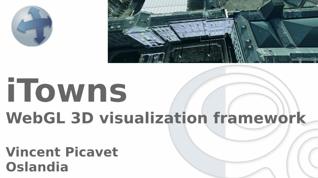
iTownsWebGL 3D visualization framework
Vincent PicavetOslandia
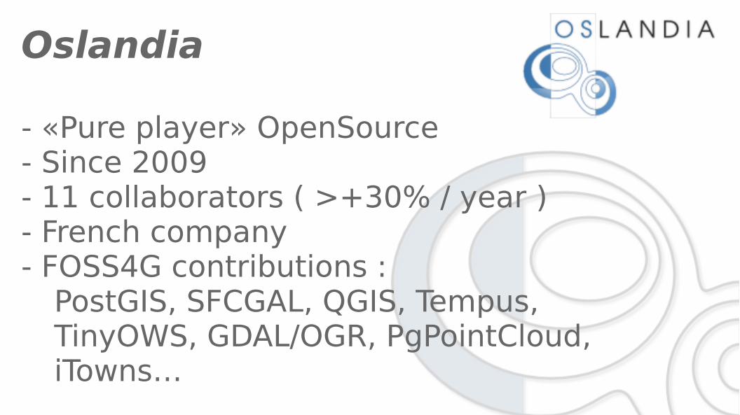
Oslandia
- «Pure player» OpenSource- Since 2009- 11 collaborators ( >+30% / year )- French company- FOSS4G contributions :
PostGIS, SFCGAL, QGIS, Tempus, TinyOWS, GDAL/OGR, PgPointCloud, iTowns…
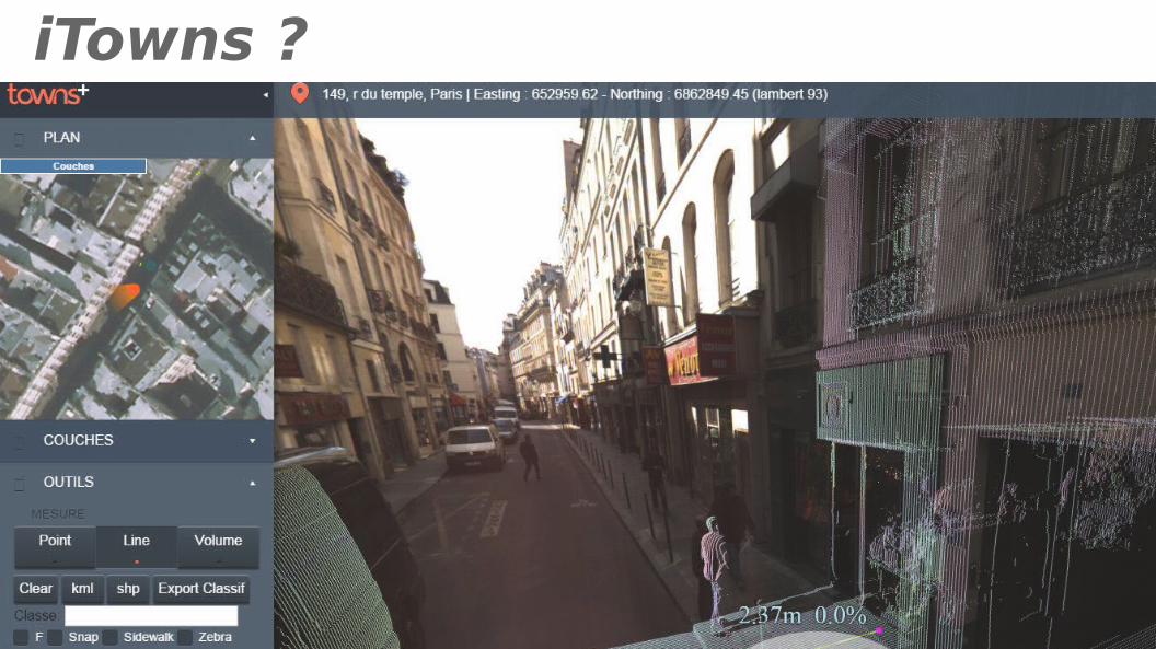
iTowns ?
Framework WebGL / JavascriptVisualización 3DNavegación immersivaTodos tipos de datos GISOpenSource
iTowns ?
WebGL / Javascript Framework3D VisualizationImmersive navigationAll types of GIS dataOpenSource ( Cecill-B & MIT )

Technical basis(iTowns 1.0 & 2.0 )
JavaScript
WebGL
THREE.JS
Shaders
iTowns : client-side
only
iTowns project – step 1/4
IGN 2008
MATIS Research laboratory (IGN)
Flash application
- Panoramic images visualization
- Object annotations
- LIDAR PointClouds
iTowns project – step 2/4
2011 : new foundation→ WebGL, GPU
- LIDAR / big volumes- Mesh support
→ Stereopolis vehicle
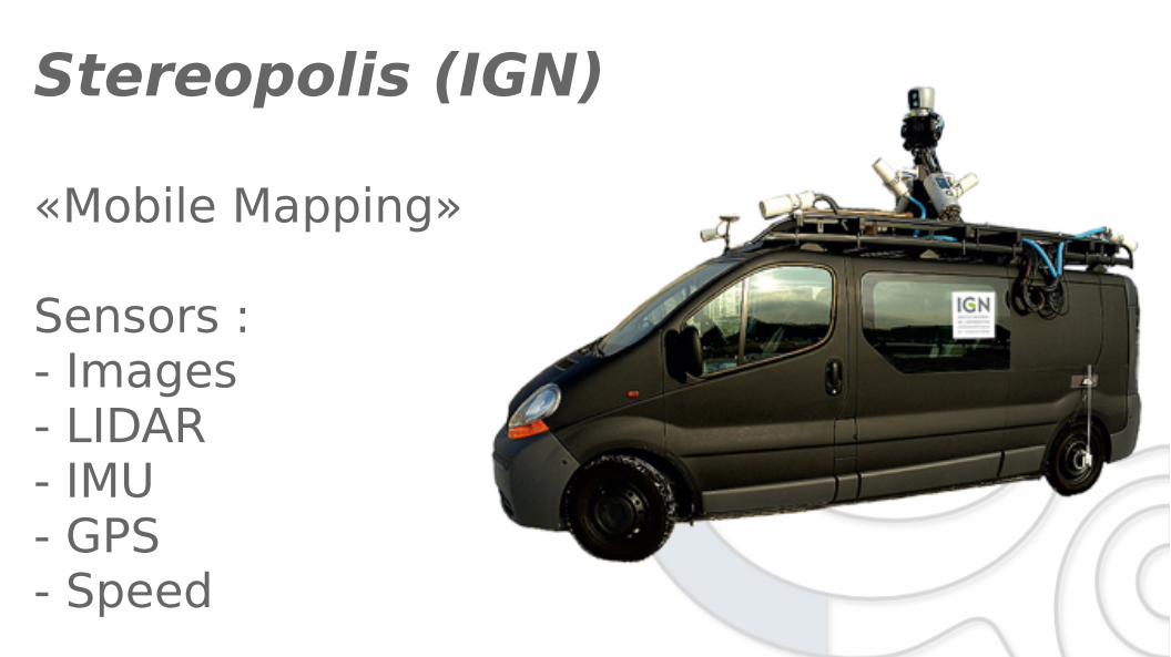
Stereopolis (IGN)
«Mobile Mapping»
Sensors : - Images - LIDAR- IMU- GPS- Speed

Sensors
Platform / vehicle
images LiDAR
IMU / GPS

Sensors
Trajectory (IMU) + GPS + odometer → position + orientation @ 200Hz
Images → 9 Images / 2m
Laser → 300K points / s
iTowns goal : Visualize these data !

iTowns OpenSource – step 3/4
08/2015 : decision to go opensource… : 1.0 source code cleaning
: first 2.x commits02/2016 : Version 1.0 release
: PSC
1.0 → operational & «Technology preview»2.x → under (heavy) development


Data types
- Oriented images
- PointClouds
- Extruded buildings ( 2D → 3D )
- Meshes ( 3D buildings with textures )
- Webservices
WMTS ( terrain, aerial imagery…)
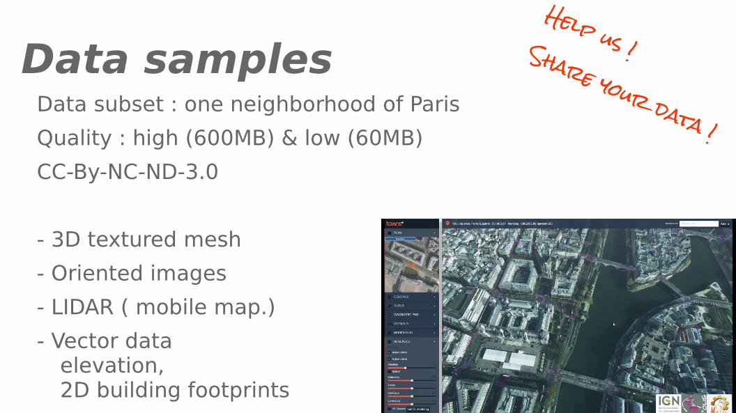
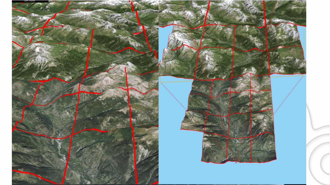
Data samplesData subset : one neighborhood of Paris
Quality : high (600MB) & low (60MB)
CC-By-NC-ND-3.0
- 3D textured mesh
- Oriented images
- LIDAR ( mobile map.)
- Vector dataelevation, 2D building footprints
Help us !Share your data !
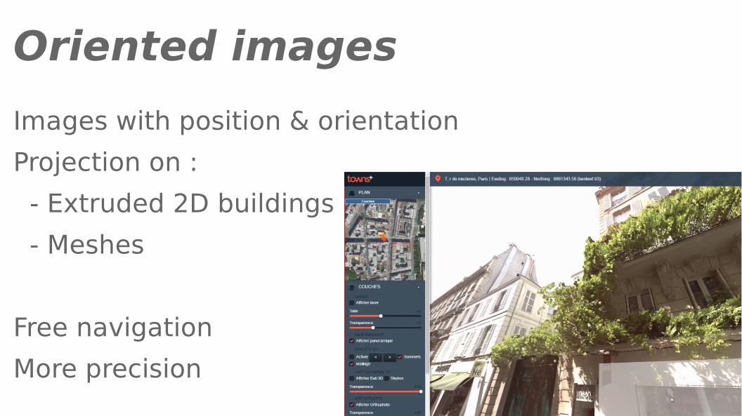
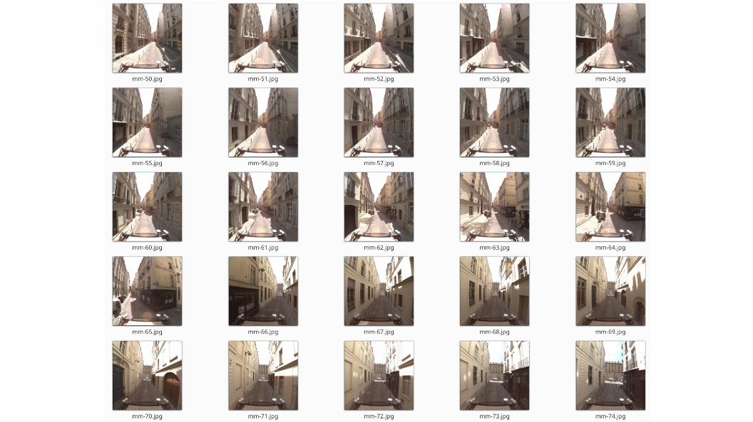
Oriented images
Images with position & orientation
Projection on :
- Extruded 2D buildings
- Meshes
Free navigation
More precision

Oriented images

Oriented images
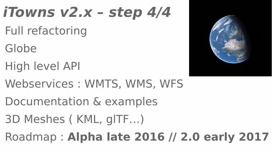
iTowns v2.x – step 4/4 Full refactoring
Globe
High level API
Webservices : WMTS, WMS, WFS
Documentation & examples
3D Meshes ( KML, glTF…)
Roadmap : Alpha late 2016 // 2.0 early 2017
Video
Use cases
iTowns v1.0 + iTowns v2.0

Potree integration → almost doneProjected images on PointClouds → PoCBuild system & CI → under workEnd-user interface
Future - features
Future - features
External API integration
- HERE
- Mapillary, others ?
Vector tiles support
3D services connection
- 3D Tiles support
- Greyhound / Entwine
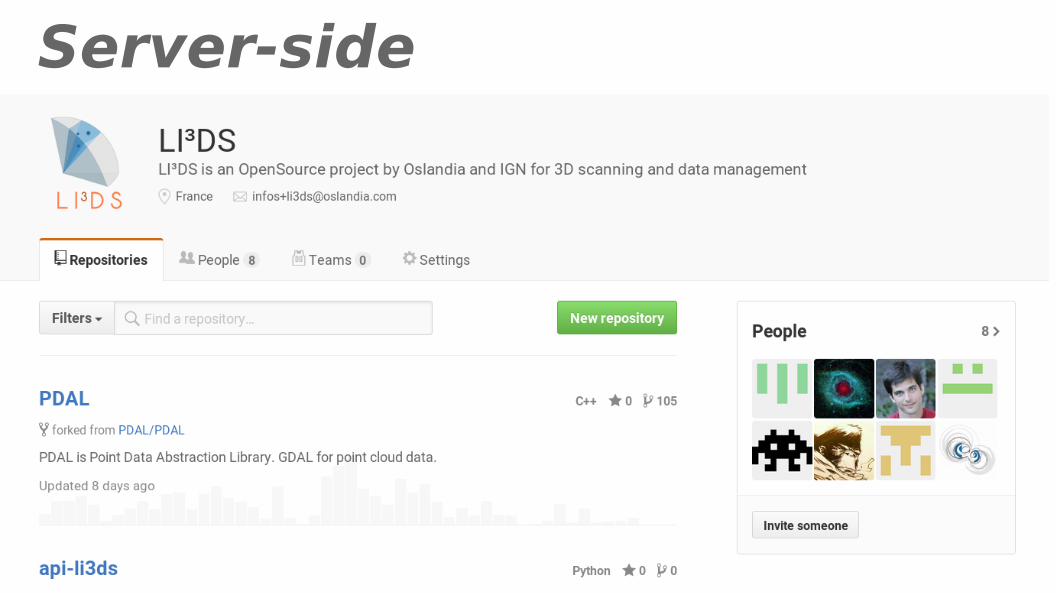
Server-side
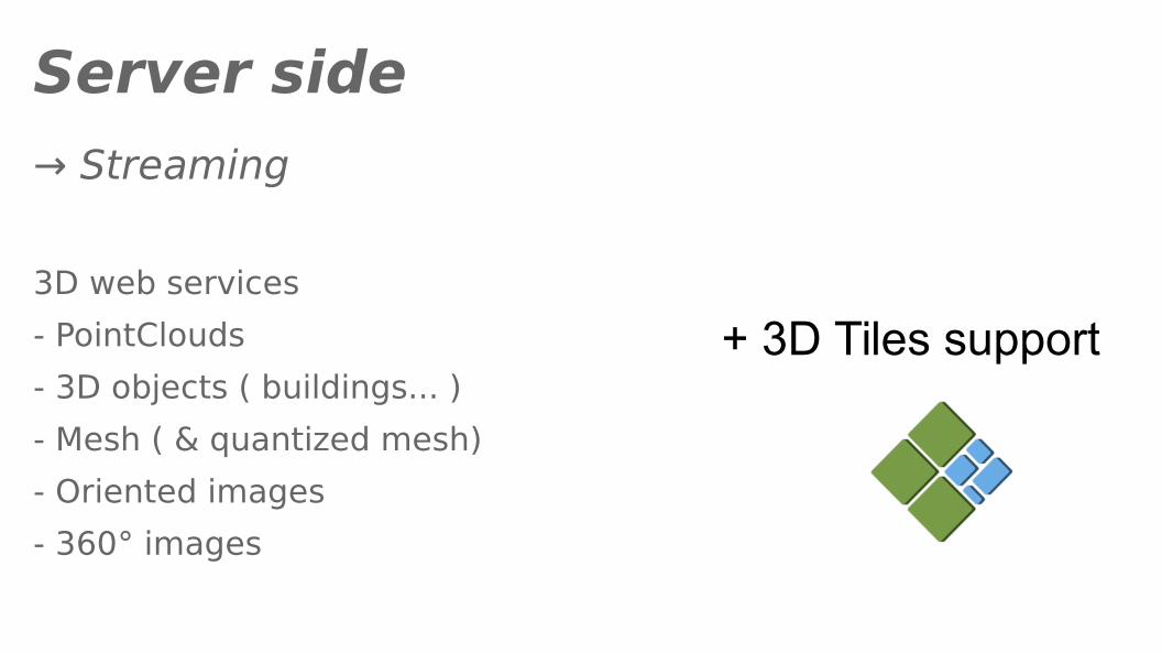
Server side
→ Streaming
3D web services
- PointClouds
- 3D objects ( buildings... )
- Mesh ( & quantized mesh)
- Oriented images
- 360° images
+ 3D Tiles support

Server-side : LOPoCS( Light OpenSource PointCloud Server )
→ Streaming point clouds from PostgreSQL
PgPointCloud / PostGIS
Python / Flask API
LAZ output ( = Greyhound )
3D Tiles output ( => OGC community standard)
https://github.com/LI3DS/lopocs
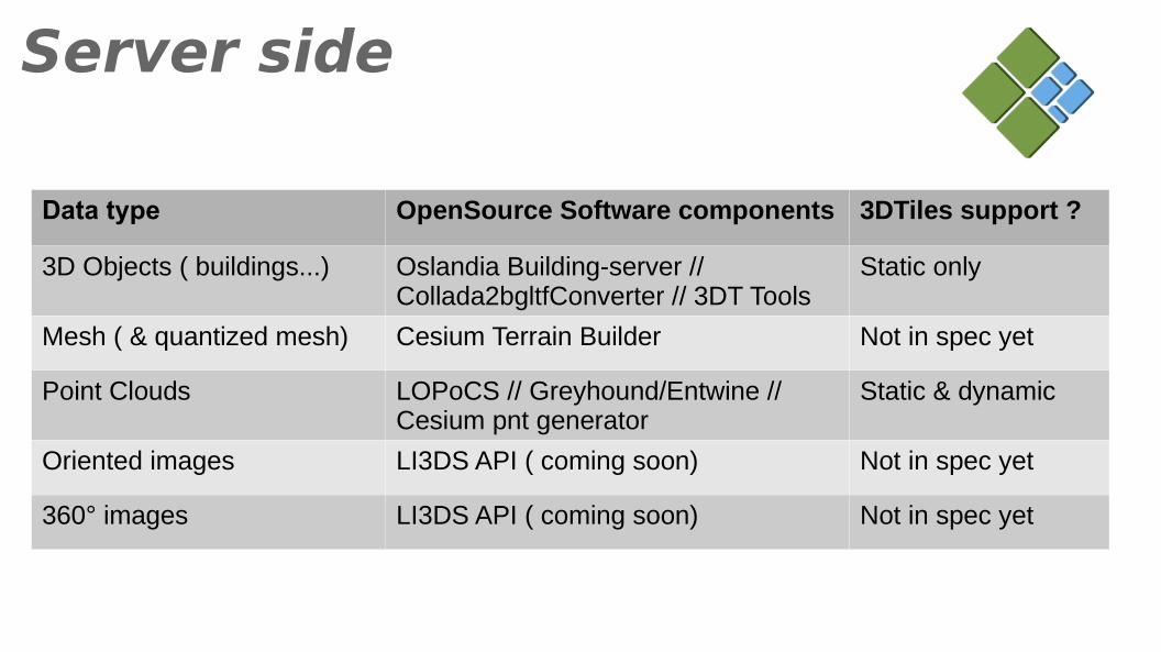
Server side
Data type OpenSource Software components 3DTiles support ?
3D Objects ( buildings...) Oslandia Building-server // Collada2bgltfConverter // 3DT Tools
Static only
Mesh ( & quantized mesh) Cesium Terrain Builder Not in spec yet
Point Clouds LOPoCS // Greyhound/Entwine // Cesium pnt generator
Static & dynamic
Oriented images LI3DS API ( coming soon) Not in spec yet
360° images LI3DS API ( coming soon) Not in spec yet
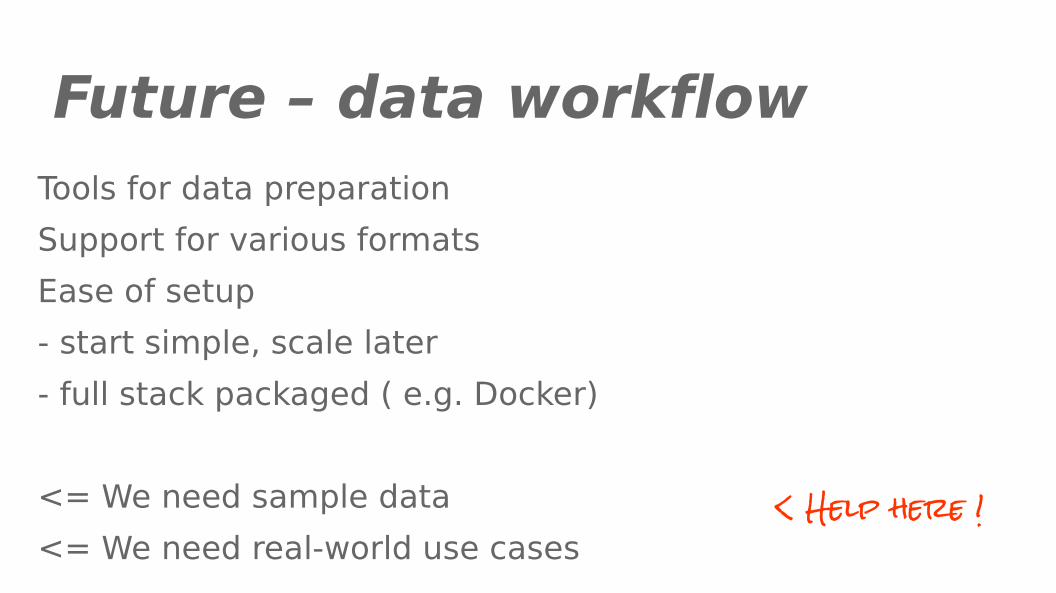
Future – data workflowTools for data preparation
Support for various formats
Ease of setup
- start simple, scale later
- full stack packaged ( e.g. Docker)
<= We need sample data
<= We need real-world use cases< Help here !

Future - project
Version 2.0
Code quality
Industrial projects
More contributors
Communication
Funding

Merci, Thanks,Questions ?
Twitter :
@vpicavet @Oslandia_Team
@Oslandia_en @Oslandia_fr
http://github.com/iTowns/itowns2
http://www.itowns-project.org
http://www.oslandia.com

- Space to street / street to space- Maturity level- Immersive visualization in iTowns- Pure WebGL / THREE.JS
iTowns vs Cesium ?