IstroboticsCAMERA ISSUES • Front side of the robot on every image • problem to paint it with the...
31
Istrobotics Robotour 2018, 16.9.2018 Pavol Boško, Peter Boško, Radoslav Kováč, Tomáš Kováč, Ivana Kováčová
Transcript of IstroboticsCAMERA ISSUES • Front side of the robot on every image • problem to paint it with the...
IstroboticsRobotour 2018, 16.9.2018Pavol Boško, Peter Boško, Radoslav Kováč, Tomáš Kováč, Ivana Kováčová
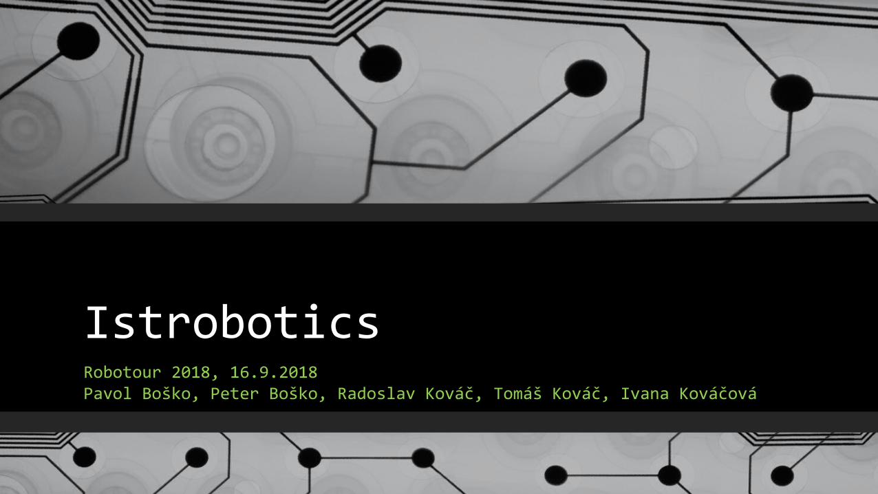
2016 2017 2018

NEW GPS TESTS
• Motivation: poor GPS performance last year
• Old GPS (blue): MTK MT3333 GPS/GLONASS
• Holux M-215+ Dual GNSS: GPS/GLONASS
• -165dBm, 66 searching, 22 tracking channels
• New GPS (green): Ublox NEO-M8 + Compass
• Concurrent reception of up to 3 GNSS (GPS, Galileo, GLONASS, BeiDou)
• –167 dBm, 72 channels, 30 tracking
• Position: every 200ms
• Issues: sometimes no course for more than 1s
• Results: the same position accuracy (10-20m)
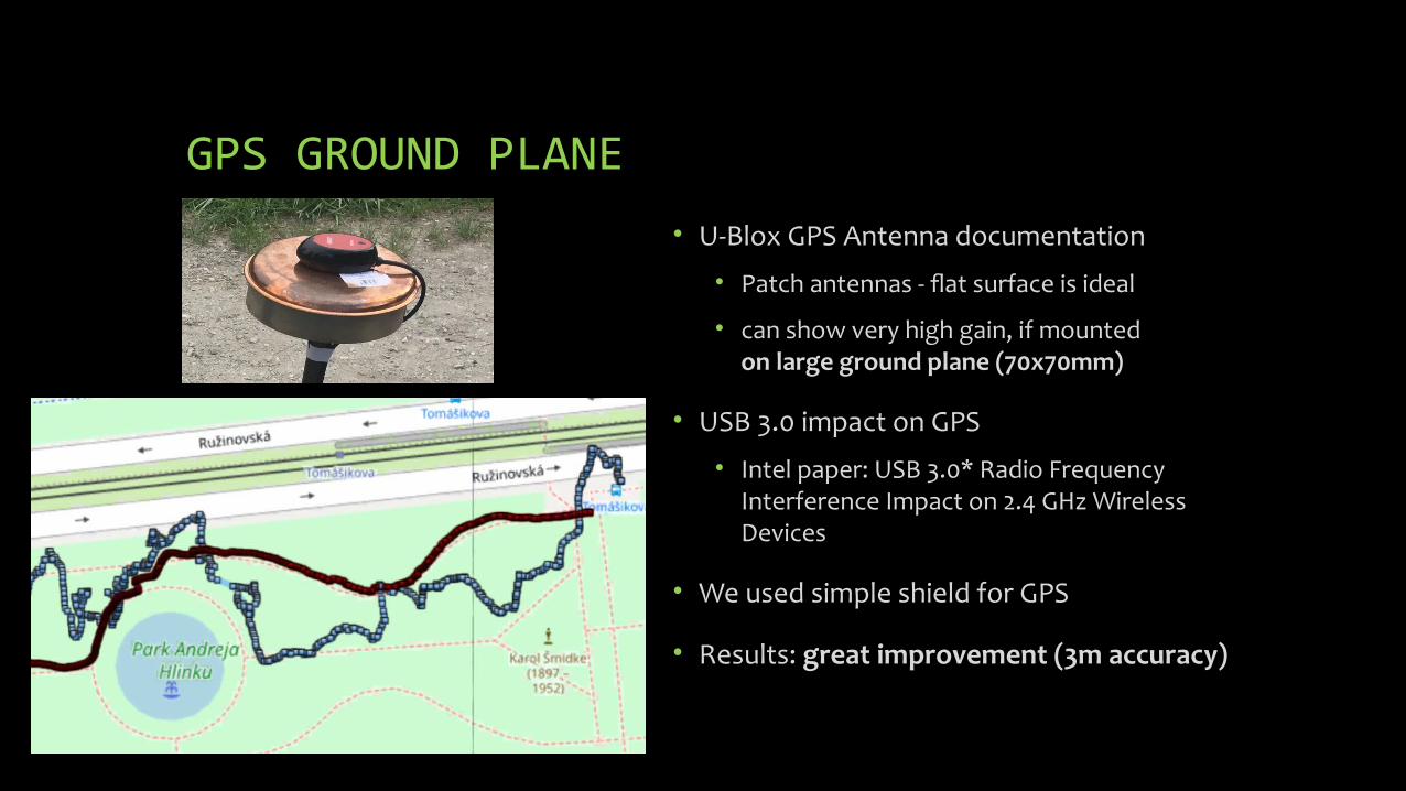
GPS GROUND PLANE
• U-Blox GPS Antenna documentation
• Patch antennas - flat surface is ideal
• can show very high gain, if mounted on large ground plane (70x70mm)
• USB 3.0 impact on GPS
• Intel paper: USB 3.0* Radio Frequency Interference Impact on 2.4 GHz Wireless Devices
• We used simple shield for GPS
• Results: great improvement (3m accuracy)

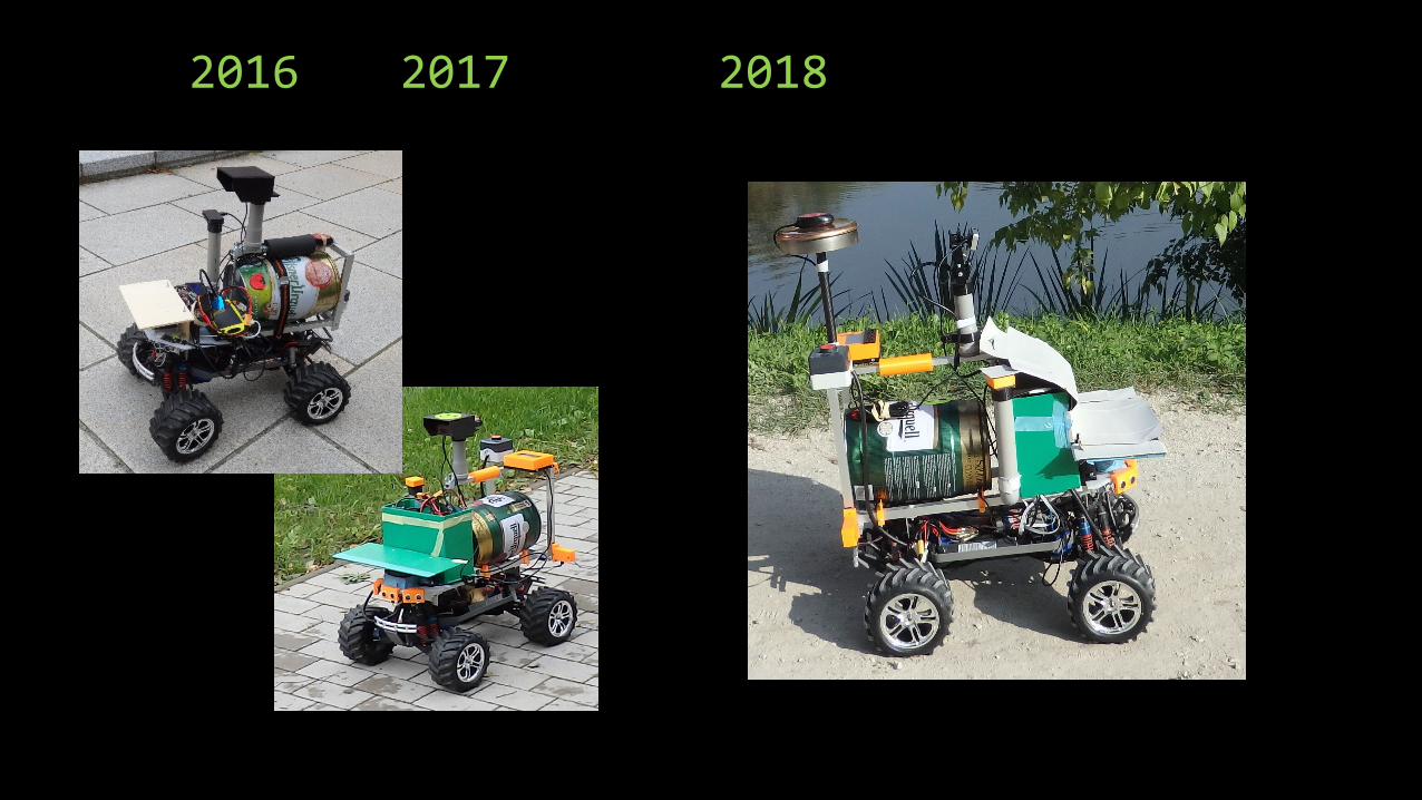
NEW 170FOV CAMERA
• oCam : 5MP USB 3.0 Camera
• OmniVision OV5640 CMOS image sensor
• Original lens Field Of View: 65 Degree
• Exchangeable Standard M12 Lens
• Separate: 170 Degree Wide Angle
• (standard accessory also for GoPro cameras)
• we 3d-printed an adjustable camera holder(fixed by screws)
• we broke the USB connector during the first test drive
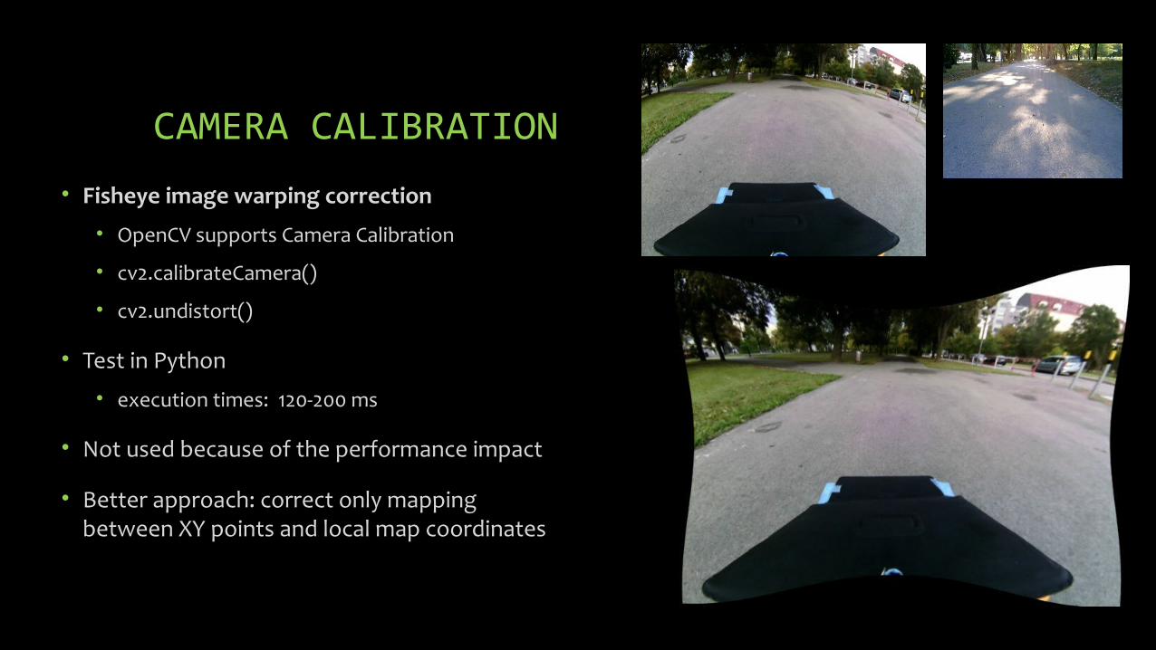
CAMERA CALIBRATION
• Fisheye image warping correction
• OpenCV supports Camera Calibration
• cv2.calibrateCamera()
• cv2.undistort()
• Test in Python
• execution times: 120-200 ms
• Not used because of the performance impact
• Better approach: correct only mapping between XY points and local map coordinates

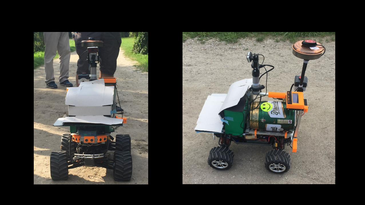
CAMERA ISSUES
• Front side of the robot on every image
• problem to paint it with the “road” color
• solution: to be fixed by SW masking
• Image is too dark
• sun/sky causes high contrast images
• our color maps did not work correctly
• solution: use a shield to hide sky?
• Roads appear too narrow
• algorithm was not able to use GPS navig. on roads
• solution: local-map geometry to be corrected


NAVIGATION – ROUTE PLANNING
• OpenStreetMap data export
• filter segments: footway, track with <grade3
• Dijkstra's Shortest Path Algorithm
• 418 nodes, 504 segments
• Performance: < 2ms
• Visualisation: kml export, cpp export
• Navigation: keep azimuth towards a point that is 10m along planned route

QR CODES
• ZBar bar code reader
• open source software suite
• supports: EAN-13/UPC-A, UPC-E, EAN-8, Code 128, Code 39, Interleaved 2 of 5 and QR Code
• Performance impact:
• one execution: 50-200ms
• our target 30-50ms per frame
• Solution: images are scanned for QR codes only when waiting for navigation coordinates

VISUALISATION
• Visualisation in web browser
• works on notebook/tablet/phone
• Messages from log files
• last set of lines matching selected substrings
• Info: robot display, gps, processing, calibration
• Log parser is exporting interesting data do .json file
• Web page performs Ajax JSON requests every 1 sec
• Images are only downloaded on demand (checkbox)

ROUND4 - DISK FULL• Round4 failure: we run out disk space
• Flash storage capacity: 64GB eMMC
• Storing to disk:
• Log file
• JPG, PNG, KML snapshots – 3-4 images/second
• ROUND2 statistics
• 33 minutes, 28.000 files
• Log file: 920MB (8.600.000)
• Camera and vision JPGs: 6.500 each
• Lidar and Grid PNGs: 6.000 each
• Navigation KMLs: 1.500

PROBLEMS
• ROUND1 (successful loading):
• not able to make a turn-around near lake
• ROUND2 (successful loading + unloading):
• turning out of the road based on navig. azimuth (no grass)
• ROUND3 (failed before loading), new camera:• camera was pointing too high
• sometimes not recognising road at all
• SW bug in “wrongway” algorithm
• ROUND4 (successful loading + unloading):
• issue with disk full terminated the application

GENERAL SLIDES
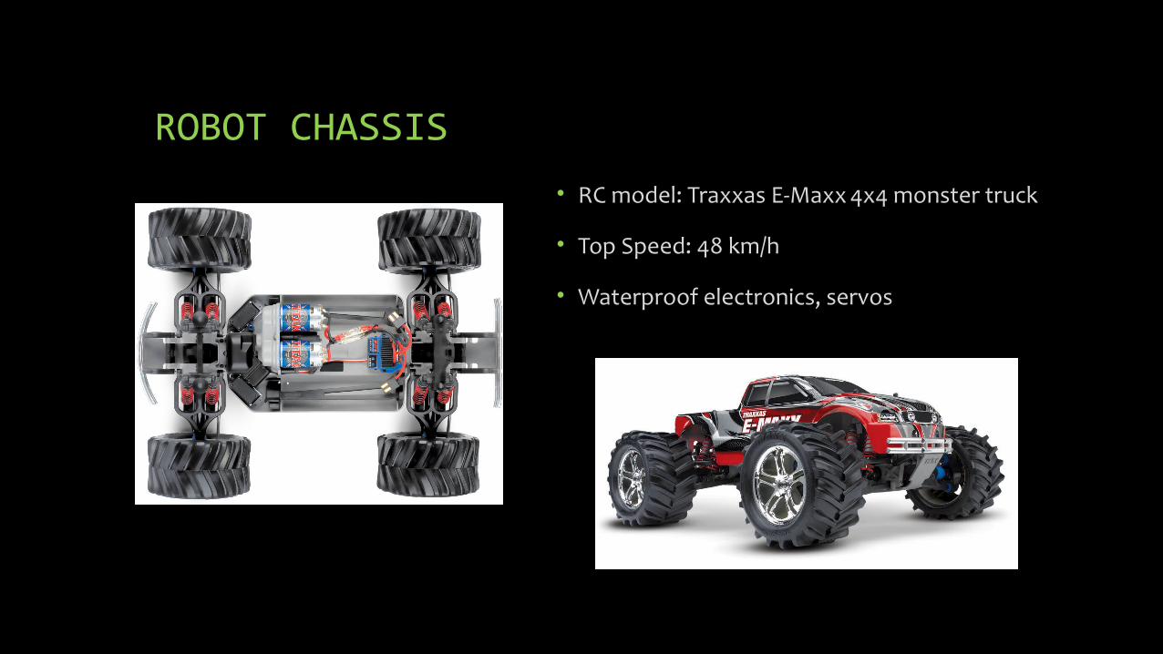
ROBOT CHASSIS
• RC model: Traxxas E-Maxx 4x4 monster truck
• Top Speed: 48 km/h
• Waterproof electronics, servos

HARDWARE DESIGN

HARDWARE• Odroid-XU4: 2GHz 8-core, 2GB RAM, 64GB Flash
• Arduino Mega: 16MHz, 8KB RAM
• 2x Arduino Nano: 16MHz, 2KB RAM
• Arduino Pro Mini: 16MHz, 2KB RAM
• 2D Lidar: RoboPeak RPLIDAR 360 ($400)
• Camera: Odroid USB Cam (640x480, 65 FOV)
• Mouse type GPS/Glonass: Holux M-215+
• Compass: Bosch BNO055
• 5x Sonar: HC - SR04
• LCD & OLED displays, 8x LED
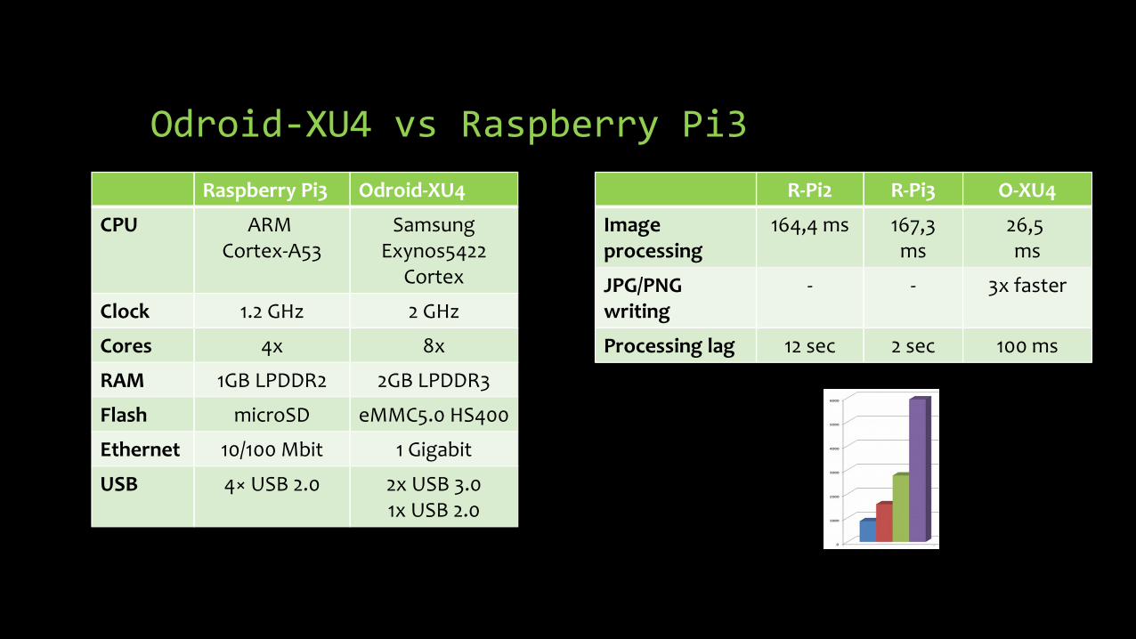
Odroid-XU4 vs Raspberry Pi3
Raspberry Pi3 Odroid-XU4
CPU ARM Cortex-A53
Samsung Exynos5422
Cortex
Clock 1.2 GHz 2 GHz
Cores 4x 8x
RAM 1GB LPDDR2 2GB LPDDR3
Flash microSD eMMC5.0 HS400
Ethernet 10/100 Mbit 1 Gigabit
USB 4× USB 2.0 2x USB 3.01x USB 2.0
R-Pi2 R-Pi3 O-XU4
Image processing
164,4 ms 167,3ms
26,5 ms
JPG/PNGwriting
- - 3x faster
Processing lag 12 sec 2 sec 100 ms
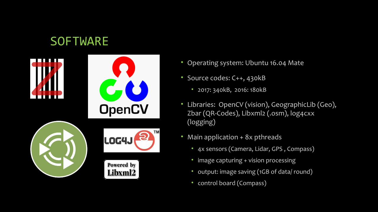
SOFTWARE• Operating system: Ubuntu 16.04 Mate
• Source codes: C++, 430kB
• 2017: 340kB, 2016: 180kB
• Libraries: OpenCV (vision), GeographicLib (Geo), Zbar (QR-Codes), Libxml2 (.osm), log4cxx (logging)
• Main application + 8x pthreads
• 4x sensors (Camera, Lidar, GPS , Compass)
• image capturing + vision processing
• output: image saving (1GB of data/ round)
• control board (Compass)

SOFTWARE DESIGN – PROCESSING
UPDATE_GRID – VISION output UPDATE_GRID – LIDAR data
READ_SENSOR_DATA – gps, compass
Calculate NAVIGATION ANGLE
CHECK_GRID for obstacles
COMPASS_CALIBRATION
WRONG_WAY behavior
OBSTACLE_AVOIDANCE – min/max
NAVIGATION
every 20ms CAMERA capture – 30 fps
LIDAR data capture – 7x /sec
VISION processing – 35 ms
GPS data capture
CONTROL BOARD comm.
SAVE images to disk – 3x /sec

LIDAR – obstacle detection
• Obstacle detection condition (red):
• If distance is < 100 cm
• Filtering: distance < 1cm (grey)
• Stop condition (pink):
• Check angle: -45 to +45 degrees
• If distance is < 50 cm at 3 diff. degs
• Sonars were also used (rain issue)
• Obstacle avoidance (green/white)
• Find OK intervals of > 20 degrees
• Choose the closest to going straight
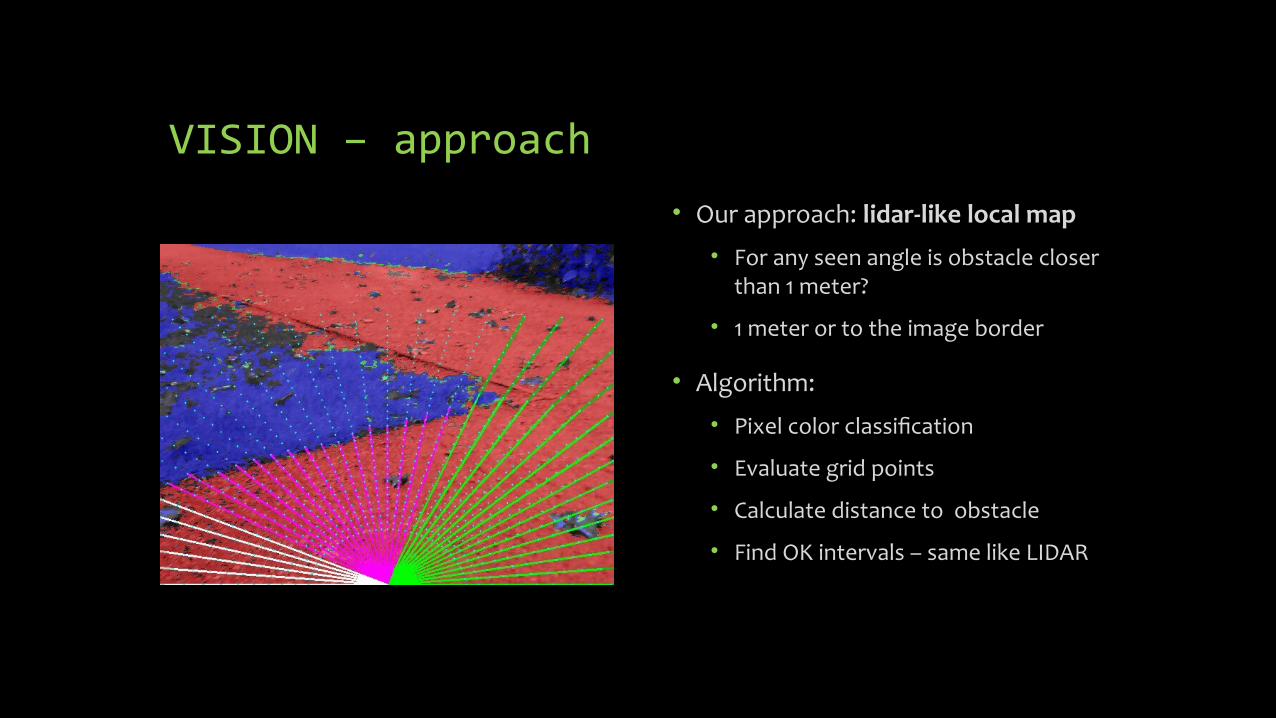
VISION – approach
• Our approach: lidar-like local map
• For any seen angle is obstacle closer than 1 meter?
• 1 meter or to the image border
• Algorithm:
• Pixel color classification
• Evaluate grid points
• Calculate distance to obstacle
• Find OK intervals – same like LIDAR

VISION – Pixel color classification
• Approach:• Choose sample pixel blocks (32x32)
from training images
• Calculate 4 clusters centers in color space (OpenCV kmeans)
• Calculate cluster radius (histogram based)
• Repeat for 2 classifiers : road and off-road (grass)
• HSV color space + Euclidian distance
• Tool was developed - to define pixel blocks and evaluate images

VISION – Algorithm• Pixel color classification - 4 results:
• Road (red)
• Off-road (blue)
• Both (green)
• None (grey)
• Evaluate grid points
• Cca 1000 points in 37 lines (5 deg)
• Evaluating nearby pixels (80x80)
• Majority of “Road” pixels is checked
• Calculate distance to obstacle
• Find OK intervals + merge with LIDAR

WAYPOINT NAVIGATION
• Navigation points: 26 manually defined points
• GPS positions taken from OpenStreetMap
• Pickup and dropoff points in arrays (navig.cpp)
• Navigation path – defined by a string “N2N1 *1 M4M5N7M3M8 *2 M7M2M3N7M5N3”
• Compass calibration:
• interval of 7 seconds - robot is moving straight
• gps and compass azimuths to be fixed
• performed every 30 seconds – 3 minutes
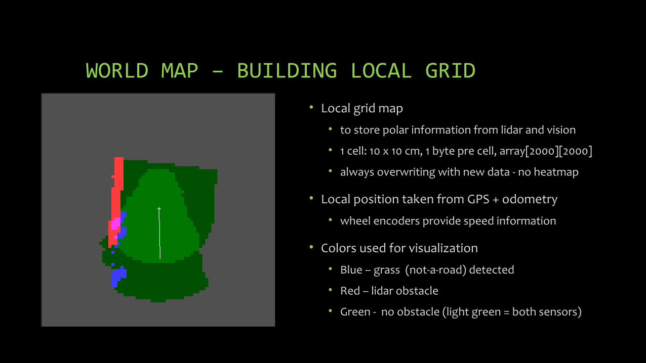
WORLD MAP – BUILDING LOCAL GRID
• Local grid map
• to store polar information from lidar and vision
• 1 cell: 10 x 10 cm, 1 byte pre cell, array[2000][2000]
• always overwriting with new data - no heatmap
• Local position taken from GPS + odometry
• wheel encoders provide speed information
• Colors used for visualization
• Blue – grass (not-a-road) detected
• Red – lidar obstacle
• Green - no obstacle (light green = both sensors)

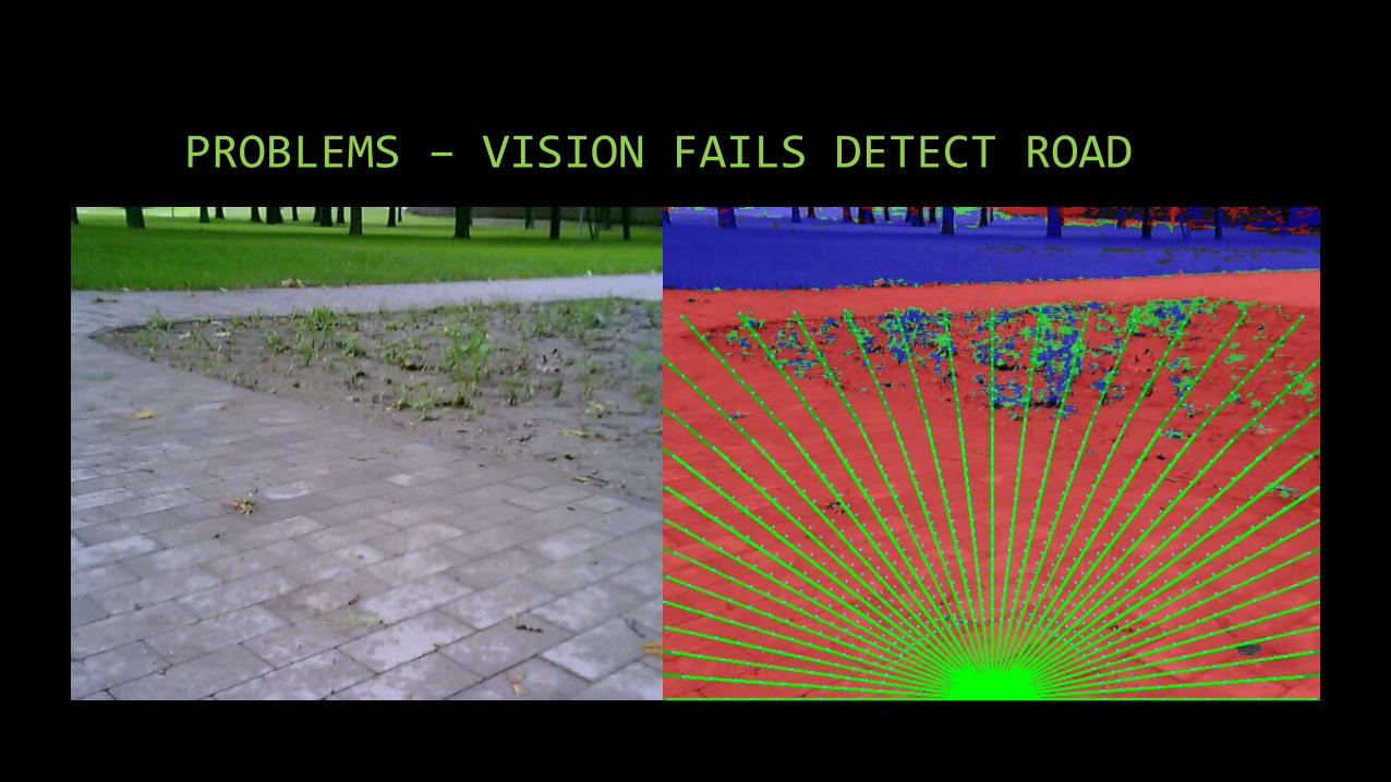
PROBLEMS – VISION FAILS DETECT ROAD

FREE SOURCE CODES
• Sources codes are available at GitHub as public project Istro RT:
https://github.com/lnx-git/istro-rt
THANK YOU


![HP Image Zone Print Job [10/27/2005 4:20 PM 57.593]ycchan/publications-ycchan/... · epesi bloqnceq we 01 sc asu;e we upe to prrc we spe pžûp bor5J$ biope llïewoq qcžqobgq to](https://static.fdocuments.fr/doc/165x107/5fad2a476e1ad30a1b1b5720/hp-image-zone-print-job-10272005-420-pm-57593-ycchanpublications-ycchan.jpg)