Final Reports of the 1972–2010 Excavations Directed by...
16
HERODIUM Final Reports of the 1972–2010 Excavations Directed by Ehud Netzer Volume I Herod’s Tomb Precinct Roi Porat, Rachel Chachy, and Yakov Kalman with contributions by: N. Ahipaz, S. Amorai-Stark, B. Arensburg, A. Barash, A. Belfer-Cohen, R. Bouchnick, A. Ecker, E. Eshel, G. Foerster, J. Gärtner, M. Hershkovitz, S. Ilani, R.E. Jackson-Tal, I. Ktalav, T. Minster, R. Nenner-Soriano, O. Peleg-Barkat, R. Sarig, D.R. Schwartz, G.D. Stiebel, D. Wachs, and B. Zissu Israel Exploration Society Institute of Archaeology, The Hebrew University of Jerusalem Jerusalem 2015
Transcript of Final Reports of the 1972–2010 Excavations Directed by...
HERODIUM
Final Reports of the 1972–2010 Excavations
Directed by Ehud Netzer
Volume I
Herod’s Tomb Precinct
Roi Porat, Rachel Chachy, and Yakov Kalman
with contributions by:
N. Ahipaz, S. Amorai-Stark, B. Arensburg, A. Barash, A. Belfer-Cohen,
R. Bouchnick, A. Ecker, E. Eshel, G. Foerster, J. Gärtner, M. Hershkovitz,
S. Ilani, R.E. Jackson-Tal, I. Ktalav, T. Minster, R. Nenner-Soriano,
O. Peleg-Barkat, R. Sarig, D.R. Schwartz, G.D. Stiebel, D. Wachs, and B. Zissu
Israel Exploration Society
Institute of Archaeology, The Hebrew University of Jerusalem
Jerusalem 2015
THIS VOLUME WAS MADE POSSIBLE BY
THE SAMIS FOUNDATION
ISBN 978-965-221-099-9
©2015 Israel Exploration Society
All rights reserved. This book may not be reproduced in whole or in part, in any form
(except for brief excerpts of reviewers), without permission from the publisher.
Editing by Robert Amoils
Layout by Avraham Pladot
Typesetting by Marzel A.S. — Jerusalem
Printed by Old City Press Ltd., Jerusalem
Contents
Samuel Israel . . . . . . . . . . . . . . . . . . . . . . . . . . . . . . . . . . . . . . . . . . . . . . . . . ix–x
Preface . . . . . . . . . . . . . . . . . . . . . . . . . . . . . . . . . . . . . . . . . . . . . . . . xi–xxi
List of Loci . . . . . . . . . . . . . . . . . . . . . . . . . . . . . . . . . . . . . . . . . . . . . xxii–xxviii
List of Illustrations, Plans, Tables, and Plates . . . . . . . . . . . . . . . . . . . . . . . . . . . xxix–xliv
PART I: Introduction
Chapter 1: Herodium in History (Daniel R. Schwartz) . . . . . . . . . . . . . . . . . . . . . . . . 1–14
Chapter 2: History of Research (Rachel Chachy) . . . . . . . . . . . . . . . . . . . . . . . . . . 15–19
PART II: Stratigraphy and Architecture
Chapter 3: The Stratigraphy in the Area of Herod’s Tomb Precinct
(Roi Porat, Yakov Kalman, and Rachel Chachy) . . . . . . . . . . . . . . . . . . . 21–200
PART III: The Mausoleum
Chapter 4: The Reconstruction of the Mausoleum (Rachel Chachy) . . . . . . . . . . . . . 201–313
Chapter 5: The Architectural Decoration of the Mausoleum
(Orit Peleg-Barkat and Rachel Chachy) . . . . . . . . . . . . . . . . . . . . . . . 314–348
Chapter 6: The Sarcophagi from the Mausoleum Unearthed at Herodium
(Gideon Foerster) . . . . . . . . . . . . . . . . . . . . . . . . . . . . . . . . . . . . 349–361
Chapter 7: Human Bones from the Area of the Mausoleum (Anna Belfer-Cohen,
Baruch Arensburg, Alon Barash, and Raheli Sarig) . . . . . . . . . . . . . . . . 362–364
PART IV: The Finds
Chapter 8: The Pottery from the Area of the Mausoleum (Judit Gärtner) . . . . . . . . . . 365–395
Chapter 9: The Glass Finds from the Area of Herod’s Tomb (Ruth E. Jackson-Tal) . . . . 396–408
Chapter 10: The Coins from Herodium — the Tomb Area (Nili Ahipaz) . . . . . . . . . . . 409–425
Chapter 11: The Metal Artifacts from the Area of the Mausoleum
(Ravit Nenner-Soriano). . . . . . . . . . . . . . . . . . . . . . . . . . . . . . . . . 426–431
Chapter 12: Military Equipment from the Area of the Mausoleum and the Theater
at Herodium (Guy D. Stiebel) . . . . . . . . . . . . . . . . . . . . . . . . . . . . . 432–453
Chapter 13: The Latin and Greek Inscribed Pottery from the Area of the Tomb
at Herodium (Avner Ecker) . . . . . . . . . . . . . . . . . . . . . . . . . . . . . . 454–459
Chapter 14: The Hebrew and Aramaic Inscriptions from the Area of the Tomb
at Herodium (Esther Eshel) . . . . . . . . . . . . . . . . . . . . . . . . . . . . . . 460–473
Chapter 15: Gem and Ring from Herodium (Malka Hershkovitz and Shua Amorai-Stark) . 474–475
Chapter 16: Finds of Animal Remains from the Excavations on the Northern Slope
of Herodium (Area A), 2006–2010 (Ram Bouchnick). . . . . . . . . . . . . . . 476–503
Chapter 17: The Molluscs (Inbar Ktalav) . . . . . . . . . . . . . . . . . . . . . . . . . . . . . . 504–510
Chapter 18: Graffito of a Ship and a Boat (Boaz Zissu) . . . . . . . . . . . . . . . . . . . . . . 511–514
Conclusions
Synthesis and Archaeological-Historical Discussion
(Roi Porat, Yakov Kalman, and Rachel Chachy) . . . . . . . . . . . . . . . . . . 515–534
Appendix I
The Geological and Morphological Structure of Herodium and the Quarries for Building
Stones and Fill Materials (Shimon Ilani, Tsevi Minster, and Daniel Wachs) . . 535–546
Color Plates
APPENDIX 1
THE GEOLOGICAL AND MORPHOLOGICAL
STRUCTURE OF HERODIUM AND THE QUARRIES
FOR BUILDING STONES AND FILL MATERIALS
Shimon Ilani, Tsevi Minster, and Daniel Wachs
Within the framework of collaboration with the Herodium excavation expedition, detailed geological
mapping of the site and its immediate surroundings was carried out in order to comprehend the mount’s
special conical structure and to determine the types of building stones and fill materials that were used in
huge quantities there. Also examined were the rocks that served for the construction of Herod’s mauso-
leum. Two main rock types were determined in the mausoleum. The first is a white limestone, bioclastic,
coarsely crystalline, hard and compact, of the meleke type, while the second is a light gray limestone,
finely crystalline, hard and compact, of the mizzi hilu type. Both of these rock types are present in the
Shivta and Nezer formations (B’ina Fm) that outcrop to the west and south of Mount Herodium. It is a
reasonable assumption that the building stones that were used for the construction of the tomb originated
from ancient quarries in the vicinity of Herodium.
The building stones found in the stairways ascending to the Mountain Palace-Fortress, the walls on top
of which they were built, and in various architectonic elements such as the round eastern tower were
mainly nari stones of the Menuha Fm, as well as stones of nari composition containing fragments of chert
from the Mishash Fm, which originated from the well-compacted colluvium rocks to the east of Mount
Herodium.
Within a range of up to 1 km from the site of Herodium were found a few places featuring signs of the
early quarrying of these rocks. These quarryings were conducted in limestones of the Shivta and Nezer
formations, in the nari “layer” that covers the Menuha Fm, in the chalky rocks of the Menuha Fm, and in
rock outcrops of the well-compacted colluviums.
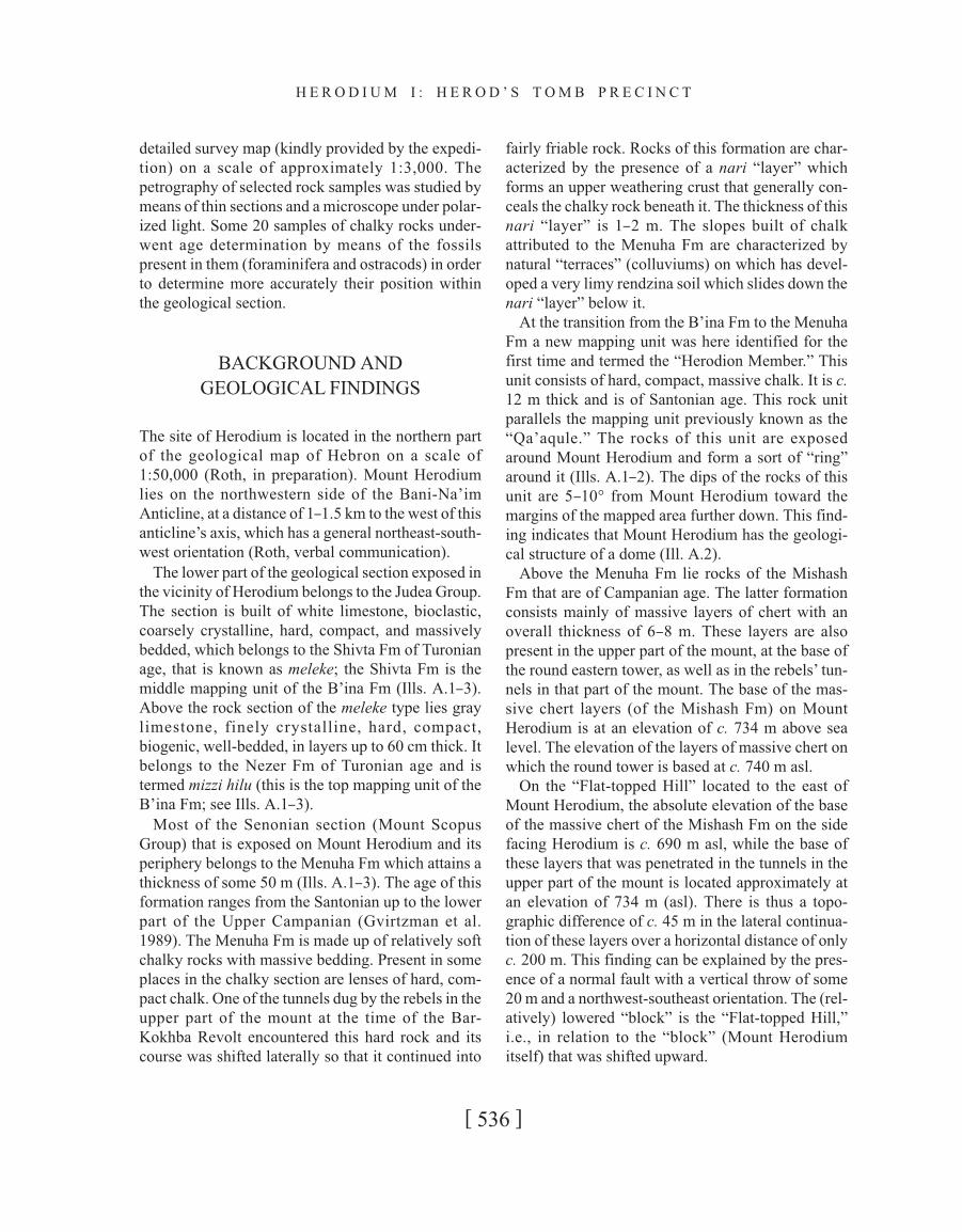
INTRODUCTION
The geological study in the area of Herodium, the
results of which are represented below, was carried
out in two stages. The first stage, conducted in
response to the approach of the late Prof. Ehud
Netzer (director of the Herodium excavation expedi-
tion, from the Archaeological Institute of the Hebrew
University) to the Geological Survey of Israel,
started in January 2008. Its aim was to examine the
possibility whether the building stones in Herod’s
tomb in particular, and at the site of Herodium in
general, had originated from ancient quarries located
fairly close to the site. Also studied were the stones
that were used for the construction of Herod’s mau-
soleum.
In the second stage, executed at the beginning of
2012 (following the approach of the excavation
expedition), detailed geological mapping of Mount
Herodium and its immediate surroundings was car-
ried out in order to gain an understanding of the site’s
geological structure and the changes that came about
following Herod’s building projects.
We were aided by orthophotos from the years
2002–2006 on a scale of c. 1:6,000 and by an aerial
photograph of Herodium and its environs taken in
1967 on an original scale of 1:7,000, as well as by a
[ 535 ]
detailed survey map (kindly provided by the expedi-
tion) on a scale of approximately 1:3,000. The
petrography of selected rock samples was studied by
means of thin sections and a microscope under polar-
ized light. Some 20 samples of chalky rocks under-
went age determination by means of the fossils
present in them (foraminifera and ostracods) in order
to determine more accurately their position within
the geological section.
BACKGROUND AND
GEOLOGICAL FINDINGS
The site of Herodium is located in the northern part
of the geological map of Hebron on a scale of
1:50,000 (Roth, in preparation). Mount Herodium
lies on the northwestern side of the Bani-Na’im
Anticline, at a distance of 1–1.5 km to the west of this
anticline’s axis, which has a general northeast-south-
west orientation (Roth, verbal communication).
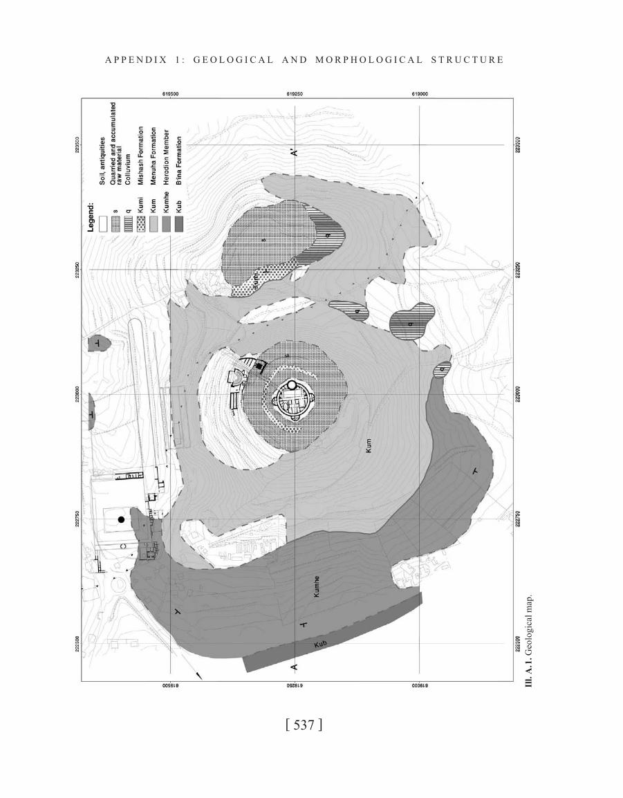
The lower part of the geological section exposed in
the vicinity of Herodium belongs to the Judea Group.
The section is built of white limestone, bioclastic,
coarsely crystalline, hard, compact, and massively
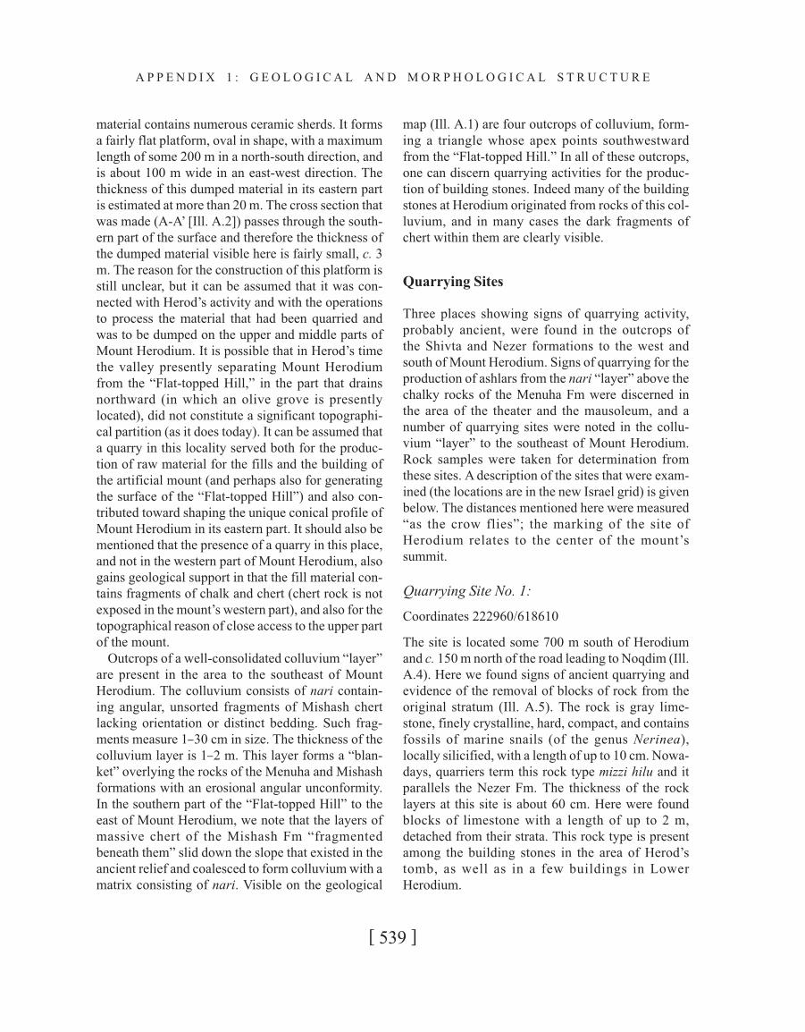
bedded, which belongs to the Shivta Fm of Turonian
age, that is known as meleke; the Shivta Fm is the
middle mapping unit of the B’ina Fm (Ills. A.1–3).
Above the rock section of the meleke type lies gray
limestone, finely crystalline, hard, compact,
biogenic, well-bedded, in layers up to 60 cm thick. It
belongs to the Nezer Fm of Turonian age and is
termed mizzi hilu (this is the top mapping unit of the
B’ina Fm; see Ills. A.1–3).
Most of the Senonian section (Mount Scopus
Group) that is exposed on Mount Herodium and its
periphery belongs to the Menuha Fm which attains a
thickness of some 50 m (Ills. A.1–3). The age of this
formation ranges from the Santonian up to the lower
part of the Upper Campanian (Gvirtzman et al.
1989). The Menuha Fm is made up of relatively soft
chalky rocks with massive bedding. Present in some
places in the chalky section are lenses of hard, com-
pact chalk. One of the tunnels dug by the rebels in the
upper part of the mount at the time of the Bar-
Kokhba Revolt encountered this hard rock and its
course was shifted laterally so that it continued into
fairly friable rock. Rocks of this formation are char-
acterized by the presence of a nari “layer” which
forms an upper weathering crust that generally con-
ceals the chalky rock beneath it. The thickness of this
nari “layer” is 1–2 m. The slopes built of chalk
attributed to the Menuha Fm are characterized by
natural “terraces” (colluviums) on which has devel-
oped a very limy rendzina soil which slides down the
nari “layer” below it.
At the transition from the B’ina Fm to the Menuha
Fm a new mapping unit was here identified for the
first time and termed the “Herodion Member.” This
unit consists of hard, compact, massive chalk. It is c.
12 m thick and is of Santonian age. This rock unit
parallels the mapping unit previously known as the
“Qa’aqule.” The rocks of this unit are exposed
around Mount Herodium and form a sort of “ring”
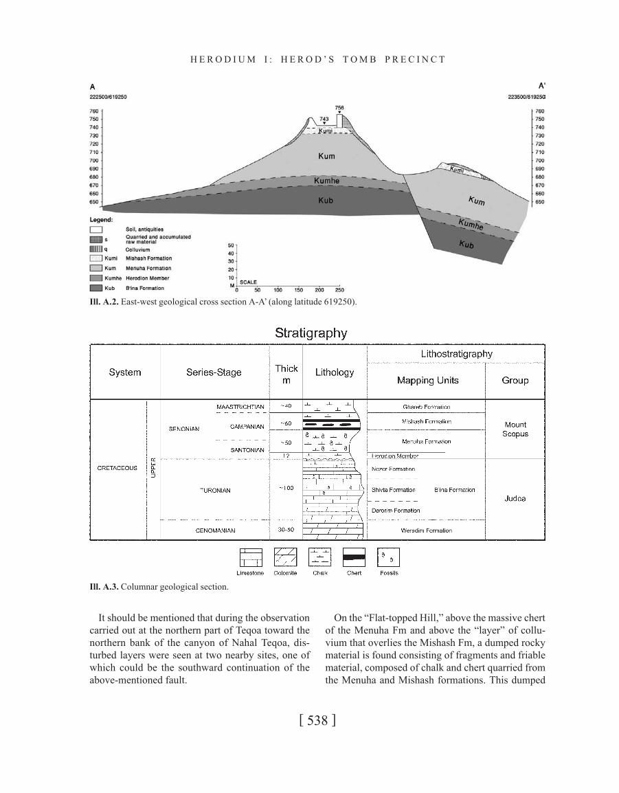
around it (Ills. A.1–2). The dips of the rocks of this
unit are 5–10° from Mount Herodium toward the
margins of the mapped area further down. This find-
ing indicates that Mount Herodium has the geologi-
cal structure of a dome (Ill. A.2).
Above the Menuha Fm lie rocks of the Mishash
Fm that are of Campanian age. The latter formation
consists mainly of massive layers of chert with an
overall thickness of 6–8 m. These layers are also
present in the upper part of the mount, at the base of
the round eastern tower, as well as in the rebels’ tun-
nels in that part of the mount. The base of the mas-
sive chert layers (of the Mishash Fm) on Mount
Herodium is at an elevation of c. 734 m above sea
level. The elevation of the layers of massive chert on
which the round tower is based at c. 740 m asl.
On the “Flat-topped Hill” located to the east of
Mount Herodium, the absolute elevation of the base
of the massive chert of the Mishash Fm on the side
facing Herodium is c. 690 m asl, while the base of
these layers that was penetrated in the tunnels in the
upper part of the mount is located approximately at
an elevation of 734 m (asl). There is thus a topo-
graphic difference of c. 45 m in the lateral continua-
tion of these layers over a horizontal distance of only
c. 200 m. This finding can be explained by the pres-
ence of a normal fault with a vertical throw of some
20 m and a northwest-southeast orientation. The (rel-
atively) lowered “block” is the “Flat-topped Hill,”
i.e., in relation to the “block” (Mount Herodium
itself) that was shifted upward.
[ 536 ]
H E R O D I U M I : H E R O D ’ S T O M B P R E C I N C T
[ 537 ]
A P P E N D I X 1 : G E O L O G I C A L A N D M O R P H O L O G I C A L S T R U C T U R E
Ill
.A
.1.G
eo
log
ical
map
.
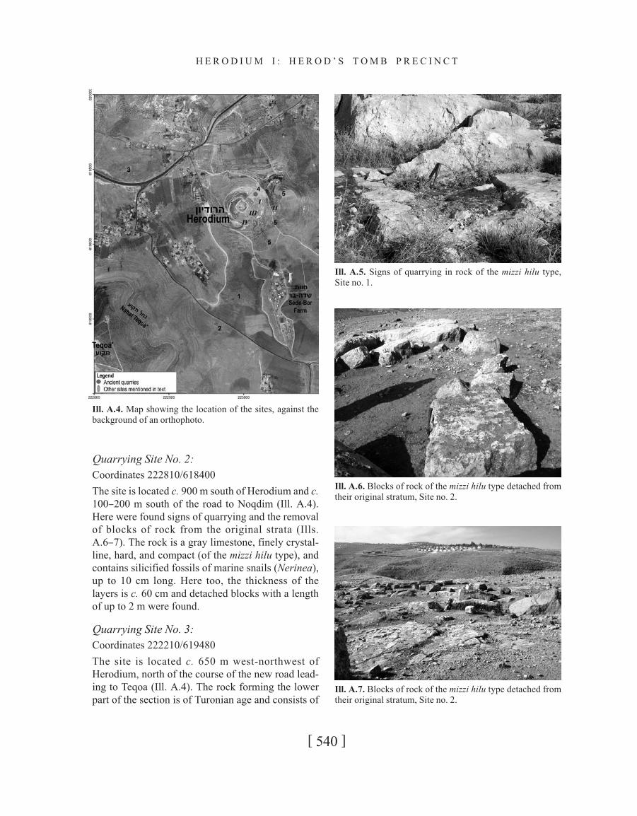
It should be mentioned that during the observation
carried out at the northern part of Teqoa toward the
northern bank of the canyon of Nahal Teqoa, dis-
turbed layers were seen at two nearby sites, one of
which could be the southward continuation of the
above-mentioned fault.
On the “Flat-topped Hill,” above the massive chert
of the Menuha Fm and above the “layer” of collu-
vium that overlies the Mishash Fm, a dumped rocky
material is found consisting of fragments and friable
material, composed of chalk and chert quarried from
the Menuha and Mishash formations. This dumped
[ 538 ]
H E R O D I U M I : H E R O D ’ S T O M B P R E C I N C T
Ill. A.2. East-west geological cross section A-A’ (along latitude 619250).
Ill. A.3. Columnar geological section.
material contains numerous ceramic sherds. It forms
a fairly flat platform, oval in shape, with a maximum
length of some 200 m in a north-south direction, and
is about 100 m wide in an east-west direction. The
thickness of this dumped material in its eastern part
is estimated at more than 20 m. The cross section that
was made (A-A’ [Ill. A.2]) passes through the south-
ern part of the surface and therefore the thickness of
the dumped material visible here is fairly small, c. 3
m. The reason for the construction of this platform is
still unclear, but it can be assumed that it was con-
nected with Herod’s activity and with the operations
to process the material that had been quarried and
was to be dumped on the upper and middle parts of
Mount Herodium. It is possible that in Herod’s time
the valley presently separating Mount Herodium
from the “Flat-topped Hill,” in the part that drains
northward (in which an olive grove is presently
located), did not constitute a significant topographi-
cal partition (as it does today). It can be assumed that
a quarry in this locality served both for the produc-
tion of raw material for the fills and the building of
the artificial mount (and perhaps also for generating
the surface of the “Flat-topped Hill”) and also con-
tributed toward shaping the unique conical profile of
Mount Herodium in its eastern part. It should also be
mentioned that the presence of a quarry in this place,
and not in the western part of Mount Herodium, also
gains geological support in that the fill material con-
tains fragments of chalk and chert (chert rock is not
exposed in the mount’s western part), and also for the
topographical reason of close access to the upper part
of the mount.
Outcrops of a well-consolidated colluvium “layer”
are present in the area to the southeast of Mount
Herodium. The colluvium consists of nari contain-
ing angular, unsorted fragments of Mishash chert
lacking orientation or distinct bedding. Such frag-
ments measure 1–30 cm in size. The thickness of the
colluvium layer is 1–2 m. This layer forms a “blan-
ket” overlying the rocks of the Menuha and Mishash
formations with an erosional angular unconformity.
In the southern part of the “Flat-topped Hill” to the
east of Mount Herodium, we note that the layers of
massive chert of the Mishash Fm “fragmented
beneath them” slid down the slope that existed in the
ancient relief and coalesced to form colluvium with a
matrix consisting of nari. Visible on the geological
map (Ill. A.1) are four outcrops of colluvium, form-
ing a triangle whose apex points southwestward
from the “Flat-topped Hill.” In all of these outcrops,
one can discern quarrying activities for the produc-
tion of building stones. Indeed many of the building
stones at Herodium originated from rocks of this col-
luvium, and in many cases the dark fragments of
chert within them are clearly visible.
Quarrying Sites
Three places showing signs of quarrying activity,
probably ancient, were found in the outcrops of
the Shivta and Nezer formations to the west and
south of Mount Herodium. Signs of quarrying for the
production of ashlars from the nari “layer” above the
chalky rocks of the Menuha Fm were discerned in
the area of the theater and the mausoleum, and a
number of quarrying sites were noted in the collu-
vium “layer” to the southeast of Mount Herodium.
Rock samples were taken for determination from
these sites. A description of the sites that were exam-
ined (the locations are in the new Israel grid) is given
below. The distances mentioned here were measured
“as the crow flies”; the marking of the site of
Herodium relates to the center of the mount’s
summit.
Quarrying Site No. 1:
Coordinates 222960/618610
The site is located some 700 m south of Herodium
and c. 150 m north of the road leading to Noqdim (Ill.
A.4). Here we found signs of ancient quarrying and
evidence of the removal of blocks of rock from the
original stratum (Ill. A.5). The rock is gray lime-
stone, finely crystalline, hard, compact, and contains
fossils of marine snails (of the genus Nerinea),
locally silicified, with a length of up to 10 cm. Nowa-
days, quarriers term this rock type mizzi hilu and it
parallels the Nezer Fm. The thickness of the rock
layers at this site is about 60 cm. Here were found
blocks of limestone with a length of up to 2 m,
detached from their strata. This rock type is present
among the building stones in the area of Herod’s
tomb, as well as in a few buildings in Lower
Herodium.
[ 539 ]
A P P E N D I X 1 : G E O L O G I C A L A N D M O R P H O L O G I C A L S T R U C T U R E
Quarrying Site No. 2:
Coordinates 222810/618400
The site is located c. 900 m south of Herodium and c.
100–200 m south of the road to Noqdim (Ill. A.4).
Here were found signs of quarrying and the removal
of blocks of rock from the original strata (Ills.
A.6–7). The rock is a gray limestone, finely crystal-
line, hard, and compact (of the mizzi hilu type), and
contains silicified fossils of marine snails (Nerinea),
up to 10 cm long. Here too, the thickness of the
layers is c. 60 cm and detached blocks with a length
of up to 2 m were found.
Quarrying Site No. 3:
Coordinates 222210/619480
The site is located c. 650 m west-northwest of
Herodium, north of the course of the new road lead-
ing to Teqoa (Ill. A.4). The rock forming the lower
part of the section is of Turonian age and consists of
[ 540 ]
H E R O D I U M I : H E R O D ’ S T O M B P R E C I N C T
Ill. A.4. Map showing the location of the sites, against the
background of an orthophoto.
Ill. A.5. Signs of quarrying in rock of the mizzi hilu type,
Site no. 1.
Ill. A.6. Blocks of rock of the mizzi hilu type detached from
their original stratum, Site no. 2.
Ill. A.7. Blocks of rock of the mizzi hilu type detached from
their original stratum, Site no. 2.
light gray-whitish limestone, bioclastic, coarsely
crystalline, hard, and compact, belonging to the
Shivta Fm, and quarriers nowadays call it meleke.
Preserved at this site are “channels” created in order
to detach blocks of stone from their original strata;
they are c. 10 cm wide and are presently filled with
earth (Ills. A.8–9). The dimensions of the building
stones that these channels were meant to detach were
c. 1 m long and c. 60 cm wide. Similar stones from
rock of the meleke type are to be found in the podium
of Herod’s mausoleum at Herodium. In the upper
part of the section of Turonian age, in a sequence
above the section of the rock of meleke type, is a
bedded gray limestone, finely crystalline, hard, com-
pact, biogenic, in layers that are 60 cm thick; it is
termed mizzi hilu. At Site no. 3, no large and com-
plete fossils of Nerinea were found within the mizzi
hilu (like those at Sites nos. 1 and 2). A large number
of present-day quarrying pits were also identified at
this site (Ill. A.9), and according to a local inhabitant,
the quarrying activity there started some 60 years
ago. In our view, it seems very likely that some of
these modern quarrying pits are operating at the sites
of ancient quarries and have thus “obliterated” signs
of quarrying from early times.
Quarrying Site No. 4:
Coordinates 223100/619300
The site is located in the area of the mausoleum,
below it and to its side. Present are signs of quarrying
for the production of ashlars, apparently for con-
struction at the top of the mount. The quarrying was
carried out in the “layer” of nari whose thickness is
up to c. 2 m; it is well consolidated and covers the
chalk of the Menuha Fm (Ill. A.10). The chalk of the
[ 541 ]
A P P E N D I X 1 : G E O L O G I C A L A N D M O R P H O L O G I C A L S T R U C T U R E
Ill. A.9. Recent quarrying in rock of the meleke type, Site no.
3.
Ill.A.8. Ancient quarrying channels in rock of the meleke
type, Site no. 3.
Ill. A.10. Ancient quarrying in the nari layer above the
Menuha Fm, Site no. 4.
Menuha Fm at this site, below the “layer” of nari, is
very fissured and thus unsuitable for the quarrying of
building stones.
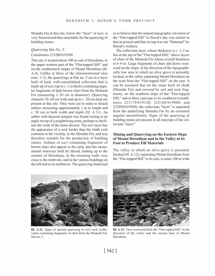
Quarrying Site No. 5:
Coordinates 223200/619300
This site is located about 300 m east of Herodium, in
the upper western part of the “Flat-topped Hill” and
on the southeastern slopes of Mount Herodium (Ill.
A.4). Unlike at three of the aforementioned sites
(nos. 1–3), the quarryings at Site no. 5 are in a layer
built of hard, well-consolidated colluvium that is
made up of nari (up to c. 2 m thick) containing angu-
lar fragments of dark brown chert from the Mishash
Fm (measuring 1–30 cm in diameter). Quarrying
channels 10–20 cm wide and up to c. 20 cm deep are
present at this site. They were cut in order to detach
ashlars measuring approximately 1 m in length and
c. 50 cm in both width and depth (Ill. A.11). An
ashlar with dressed margins was found resting at an
angle on top of a neighboring stone, perhaps to facili-
tate the work of the stone-dresser. The nari layer has
the appearance of a rock harder than the chalk rock
common in the vicinity, in the Menuha Fm, and was
therefore suitable for the production of building
stones. Ashlars of nari containing fragments of
brown chert also appear in the early and late monu-
mental stairways built by Herod, leading up to the
summit of Herodium, in the retaining walls very
close to the tomb site, and in the various buildings on
the hill and to its northwest. The quarrying finds lead
us to believe that the natural topographic elevation of
the “Flat-topped Hill” in Herod’s day was similar to
that at present and thus its top was not “flattened” by
Herod’s workers.
The colluvium layer, whose thickness is c. 1–2 m,
lies at the top of the “Flat-topped Hill,” above layers
of chert of the Mishash Fm whose overall thickness
is 6–8 m. Large fragments of chert slid down west-
ward on the slope, in the direction of the topographi-
cally low area in which an olive grove is presently
located, in the valley separating Mount Herodium on
the west from the “Flat-topped Hill” on the east. It
can be assumed that on the slope built of chalk
(Menuha Fm) and covered by soil and rock frag-
ments, on the southern slope of the “Flat-topped
Hill,” and in three outcrops to its southwest (coordi-
nates 223170/619120; 223160/619000; and
223050/618950), the colluvium “layer” is separated
from the underlying Menuha Fm by an erosional
angular unconformity. Signs of the quarrying of
building stones are present in all outcrops of the col-
luvium “layer.”
Mining and Quarrying on the Eastern Slope
of Mount Herodium and in the Valley at its
Foot to Produce Fill Materials
The valley in which an olive grove is presently
located (Ill. A.12), separating Mount Herodium from
the “Flat-topped Hill” to its east, is some 100 m wide
[ 542 ]
H E R O D I U M I : H E R O D ’ S T O M B P R E C I N C T
Ill. A.11. Signs of ancient quarrying in nari rock (collu-
vium) containing fragments of chert from the Mishash Fm,
Site no. 5.
Ill. A.12. View westward from the “Flat-topped Hill” in the
direction of the valley and the eastern base of Mount
Herodium.
at its flanks and has a length of c. 230 m (opposite the
area from which colluvium was removed on the east-
ern side of Mount Herodium; Ill. A.13). One can
learn about the composition of the original material
that covered the valley, at least in its southern part,
from an examination of the quarry walls located on
its eastern fringe at coordinates 223250/619250 (no.
II on Ill. A.4). The rock is unconsolidated material,
colluvium, mainly containing fragments of chalk and
chert, angular and unsorted, as well as lenses of
brown soil. This composition probably matches the
material that was dumped as the bottom layer in the
upper part of Mount Herodium, around the walls, at
the time of construction of the artificial mound. This
layer was compacted on top of the bedrock which is a
layer of nari covering the chalk rock of the Menuha
Fm. In connection with the mining of the material in
the area of this valley, two scenarios merit consider-
ation.
a) If the material that was used for this bottom layer
was brought from the valley in question, then it is
possible that at the same time as the mined material
was being dumped around the walls of the fortress in
the upper part of Mount Herodium, Herod’s workers
could have been mining and deepening the valley in
order to create a greater difference in elevation on the
eastern slope of the mount, and also in order to pro-
duce material for dumping around the walls of the
fortress. If the maximum depth of the mining of this
colluvium material is estimated at 5 m, over a length
of c. 200 m and a width of c. 50 m, then one can assess
that the amount of material mined in this valley to
form the bottom layer was c. 50,000 cubic meters.
[ 543 ]
A P P E N D I X 1 : G E O L O G I C A L A N D M O R P H O L O G I C A L S T R U C T U R E
Ill. A.13. Aerial photograph of Herodium and its surroundings, taken in 1967 (approximate scale — 1:7,000).
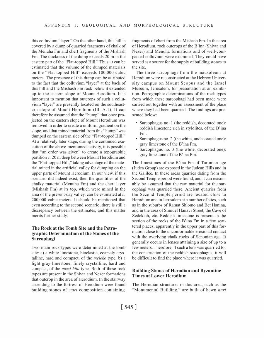
Since there are signs of the mining of the chalky
rock of the Menuha Fm in the lower eastern part of
Mount Herodium (Ill. A.12), one can reasonably
assume that, prior to the quarrying of the chalk, the
colluvium lying on top of the eastern and southeast-
ern slope of the hill was mined. This colluvium
mainly contained unsorted fragments of chalk from
the Menuha Fm, fragments of unsorted, angular
chert (that slid down from the bottom part of the
Mishash Fm that is located at the top of the section
on Mount Herodium), and also gray rendzina soil.
On the assumption that the average thickness of the
colluvium “layer” on the eastern slope was c. 1.5 m
and that it was removed to a height of c. 30 m from
the base of the slope, over a horizontal distance of c.
200 m, the volume of the “layer” that was removed
here would then have been c. 10,000 cubic meters.
Evidence of the quarrying of the chalk rock of the
Menuha Fm at the base of Mount Herodium is pres-
ent in the part facing the valley, over a length of c.
200 m and up to a height of 30 m from the valley. The
quarrying in the chalk rock is notable in the field (Ill.
A.14; no. III in Ill. A.4), since the eastern slope of
Mount Herodium is “smooth,” with signs of quarry-
ing in the bottom third. The colluvium that had been
present here (and apparently can be seen to cover the
other slopes of the hill) was removed. In Ill. A.14 one
can discern quarried areas with a square outline
having a length of c. 15–20 m, located at the base of
the slope. These square areas are bounded by shal-
low “channels” in which soil has accumulated on
which vegetation has grown. On the southeastern
slope, the original chalk rocks of the Menuha Fm
have remained on the surface of the area; they were
not quarried or removed (Ill. A.14; no. IV in Ill. A.4).
In a section parallel to the slope, these chalk rocks
form a sort of “peg” whose thickness at the base of
the slope is 3–4 m and decreases further up until it
disappears in the area where the angle of the slope
changes (Ill. A.14). On the assumption that the depth
of quarrying of the chalk rock of the Menuha Fm was
c. 2 m along the slope (in a general north-south direc-
tion), a close estimate puts the volume of quarried
chalk of the Menuha Fm facing the eastern slope at
approximately 20,000 cubic meters. The quarried
chalk was apparently used for the deposition of the
“top layer” around the walls of the fortress and on the
top of the upper slopes. This “top layer” was made up
solely of unsorted fragments of chalk rock and does
not contain brown soil and angular fragments of
chert, as does the “bottom layer,” which was depos-
ited beneath it and compacted directly on top of the
bedrock. The overall quantities estimated here are c.
80,000 cubic meters.
The quantities of material dumped around the
walls of the fortress at the top of Mount Herodium
are estimated to be of the order of c. 380,000 cubic
meters (Roi Porat, verbal communication). This
figure is very large in relation to the quantities esti-
mated by us above.
b) A second scenario relating to the quarrying to the
east of Mount Herodium, in which an attempt is
made to bridge the gap between the various quantita-
tive estimates.
It is possible that in Herod’s day the “Flat-topped
Hill” was joined to Mount Herodium and that the
presently existing valley is an artificial one that was
formed as a result of the mining of the chalk of the
Menuha Fm in order to bring about the special coni-
cal shape of Mount Herodium. It has already been
mentioned that at the back of the “Flat-topped Hill,”
at a topographical elevation of c. 700 m asl, the well-
consolidated colluvium “layer,” which contains frag-
ments of unsorted chert of the Mishash Fm and fea-
tures signs of quarrying for the production of ashlars,
is exposed, i.e., no other sedimentary rock covered
[ 544 ]
H E R O D I U M I : H E R O D ’ S T O M B P R E C I N C T
Ill. A.14. Ancient quarrying in chalky rock (Menuha Fm) on
the eastern slope of Mount Herodium (no. III on Ill. A.4). In
the background to the left is seen a section of the original
slope that was not quarried (no. IV on Ill. A.4).
this colluvium “layer.” On the other hand, this hill is
covered by a dump of quarried fragments of chalk of
the Menuha Fm and chert fragments of the Mishash
Fm. The thickness of the dump exceeds 20 m in the
eastern part of the “Flat-topped Hill.” Thus, it can be
estimated that the volume of the dumped materials
on the “Flat-topped Hill” exceeds 100,000 cubic
meters. The presence of this dump can be attributed
to the fact that the colluvium “layer” at the back of
this hill and the Mishash Fm rock below it extended
up to the eastern slope of Mount Herodium. It is
important to mention that outcrops of such a collu-
vium “layer” are presently located on the southeast-
ern slope of Mount Herodium (Ill. A.1). It can
therefore be assumed that the “hump” that once pro-
jected on the eastern slope of Mount Herodium was
removed in order to create a uniform gradient on the
slope, and that mined material from this “hump” was
dumped on the eastern side of the “Flat-topped Hill.”
At a relatively later stage, during the continued exe-
cution of the above-mentioned activity, it is possible
that “an order was given” to create a topographic
partition c. 20 m deep between Mount Herodium and
the “Flat-topped Hill,” taking advantage of the mate-
rial mined in the artificial valley for dumping on the
upper parts of Mount Herodium. In our view, if this
scenario did indeed exist, then the quantities of the
chalky material (Menuha Fm) and the chert layer
(Mishash Fm) at its top, which were mined in the
area of the present-day valley, can be estimated at c.
200,000 cubic meters. It should be mentioned that
even according to the second scenario, there is still a
discrepancy between the estimates, and this matter
merits further study.
The Rock at the Tomb Site and the Petro-
graphic Determination of the Stones of the
Sarcophagi
Two main rock types were determined at the tomb
site: a) a white limestone, bioclastic, coarsely crys-
talline, hard and compact, of the meleke type, b) a
light gray limestone, finely crystalline, hard and
compact, of the mizzi hilu type. Both of these rock
types are present in the Shivta and Nezer formations
that outcrop in the area of Herodium. In the stairway
ascending to the fortress of Herodium were found
building stones of nari composition containing
fragments of chert from the Mishash Fm. In the area
of Herodium, rock outcrops of the B’ina (Shivta and
Nezer) and Menuha formations and of well-com-
pacted colluvium were examined. They could have
served as a source for the supply of building stones to
the site.
The three sarcophagi from the mausoleum at
Herodium were reconstructed at the Hebrew Univer-
sity campus on Mount Scopus and the Israel
Museum, Jerusalem, for presentation at an exhibi-
tion. Petrographic determinations of the rock types
from which these sarcophagi had been made were
carried out together with an assessment of the place
where they had been quarried. The findings are pre-
sented below:
• Sarcophagus no. 1 (the reddish, decorated one):
reddish limestone rich in stylolites, of the B’ina
Fm.
• Sarcophagus no. 2 (the white, undecorated one):
gray limestone of the B’ina Fm.
• Sarcophagus no. 3 (the white, decorated one):
gray limestone of the B’ina Fm.
The limestones of the B’ina Fm of Turonian age
(Judea Group) are exposed in the Judean Hills and in
the Galilee. In these areas quarries dating from the
Second Temple period were found, and it can reason-
ably be assumed that the raw material for the sar-
cophagi was quarried there. Ancient quarries from
the Second Temple period are located close to
Herodium and in Jerusalem at a number of sites, such
as in the suburbs of Ramat Shlomo and Bet Hanina,
and in the area of Shmuel Hanavi Street, the Cave of
Zedekiah, etc. Reddish limestone is present in the
section of the rocks of the B’ina Fm in a few scat-
tered places, apparently in the upper part of this for-
mation close to the unconformable erosional contact
with the overlying chalk rocks of Senonian age. It
generally occurs in lenses attaining a size of up to a
few meters. Therefore, if such a lens was quarried for
the construction of the reddish sarcophagus, it will
be difficult to find the place where it was quarried.
Building Stones of Herodian and Byzantine
Times at Lower Herodium
The Herodian structures in this area, such as the
“Monumental Building,” are built of hewn nari
[ 545 ]
A P P E N D I X 1 : G E O L O G I C A L A N D M O R P H O L O G I C A L S T R U C T U R E
stones. This type of stone does not contain chert frag-
ments and thus most probably originates from the
nari layer overlying the Senonian Menuha Fm cov-
ering the slopes of Mount Herodium. At coordinates
222800/619400, to the south of and near Lower
Herodium, there is a prominent cavea-like depres-
sion facing northward. Its length is c. 80 m and its
width ca 50 m. The nari that covers a layer within
this morphological feature is missing although it is
exposed on its shoulders. It is thus possible that the
source of the aforementioned nari stones was within
this site, but the recent soil cover and slumping con-
ceal signs of quarrying. Many of these hewn stones
were reused during the Byzantine period for the con-
struction of houses and churches at the site.
Three Byzantine churches were revealed at Lower
Herodium:
a. The Central Church, located at coordinates
222820/619510, is built of hewn stones made of
nari that covers the Menuha Fm, as well as
ashlars made of “fresh” limestone of the meleke
and mizzi hilu types, featuring the typical
“Herodian” margins. Some of them are decorated
with carved rosettes with joined triglyphs, typical
of a monumental “Herodian” facade. Thus, it is
assumed that these ashlars were retrieved by the
Byzantine builders from a Herodian building that
probably stood nearby in Lower Herodium.
b. The Eastern Church is located at coordinates
223010/619500. It stands on a large platform on
top of a complex of arches built of hewn nari
stones of the type that covers the Menuha Fm.
The Herodian “Large Palace” probably stood on
this platform. Also the church is built of hewn
nari stones, as well as ashlars made of “fresh”
limestone of the meleke and mizzi hilu type. These
ashlars lack the aforementioned Herodian mar-
gins and are quite similar to the stones found at
the site of the mausoleum.
c. The Northern Church, located at coordinates
222820/619715, is built mostly of hewn stones
made of nari that covers the Menuha Fm.
Ashlars made of “fresh” limestone of the meleke and
mizzi hilu types are also found in the southernmost
room of the substructure of the “Eastern Hall” of the
Pool Complex, at coordinates 222860/619550. Some
of them feature the typical Herodian margins. The
base of the walls of this building is built of hewn
stones made of nari that covers the Menuha Fm.
ACKNOWLEDGMENTS
We are greatly indebted to the late Prof. Ehud Netzer,
director of the Herodium excavation expedition, to
Yakov Kalman and Roi Porat, members of the expe-
dition, and Shim’on Gasanov, to Dr. B. Z. Begin, Dr.
N. Lanski, Dr. A. Burg, and Dr. Z. Levy for their
helpful comments, to Mrs. R. Simon-Tov, Dr. A.
Honigstein, and Dr. A. Almogi for age determina-
tions by means of microfossils, to Dr. D. Mevorach
of the Israel Museum, Jerusalem, to Mrs. H. Netzer-
Cohen, B. S. Cohen, and N. Almog for their contri-
butions in drafting the illustrations, editing, and the
production of this report, to Y. Rafael for technologi-
cal assistance, and to R. Amoils for translating the
Hebrew text into English.
BIBLIOGRAPHY
Gvirtzman G., Almogi-Labin A., Moshkovitz S.,
Honigstein A., and Reiss Z. (1989). “Upper Creta-
ceous High-resolution Multiple Stratigraphy, North-
ern Margins of the Arabian Platform, Central Israel,”
Cretaceous Research 10: 107–135.
Roth Y. (in preparation). “The Geological Map of Hebron
on a Scale of 1:50,000,” the Geological Survey of
Israel, Jerusalem.
[ 546 ]
H E R O D I U M I : H E R O D ’ S T O M B P R E C I N C T